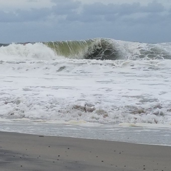
Water from Roanoke Sound pounds the Virginia Dare Trail in Manteo, N.C., Saturday, Sept. 3, 2016 as Tropical Storm Hermine passes the Outer Banks. Hermine lost hurricane strength over land but was intensifying Saturday along the Atlantic Coast, threatening heavy rain, wind and storm surges on its northward march. (AP Photo/Tom Copeland)
Hermine will remain a force to reckon with Sunday, as it travels northeast along the East Coast, before an expected northward turn later today.
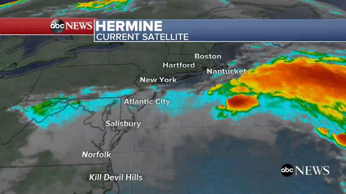
Currently considered a post-tropical cyclone, Hermine's top sustained winds remained at 65 mph this morning, as it moved east-northeast at 13 mph. Early Sunday morning, it was centered about 240 miles southeast of Ocean City, Maryland.
ABC News meteorologist Dan Manzo says to expect a "dangerous storm surge on Sunday from Virginia to New Jersey," which will bring strong winds, coastal erosion and rip currents. Coastal areas will be impacted the most, Manzo says.
Manzo further explains what to expect: "Hermine is moving towards the northeast and is expected to turn northward later today, followed by a turn northwestward late Sunday night," he said. "It is during this time period that we expect the most significant impacts from Hermine along the Northeast coastline...Life-threatening storm surge is expected within the next 36 hours from Virginia to Sandy Hook, New Jersey."
 The Associated Press
Below, Hermine's presence was already visible in Holgate, New Jersey, on Saturday.
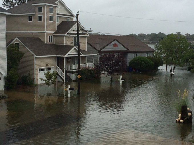
Below, images and video via ABC 13 in Norfolk, Virginia.
Heavy rains from #Hermine have flooded roads! A viewer sent us this pic from Ocean View. #13StormMode
STORM MODE PHOTOS: Find your #13StormMode photos of how #Hermine has affected Hampton Roads:on.wvec.com/2c0XvuO
Driving down Poquoson Avenue in the #13NewsNow live truck. More on post #Hermine conditions at 11 #13StormMode.
Looking ahead, Manzo says, "The risk for major storm surge then spreads northward to southern New England on Sunday night and Monday...Tropical Storm force winds, greater than 39 mph, will spread northward on Sunday and last into Monday and possibly part of Tuesday. Hermine will then meander offshore in this area for the next several days."
Moderate to major flooding is expected in Seaside Heights, New Jersey; Atlantic City, New Jersey; Cape May, New Jersey; Lewes, Delaware; and Rehoboth Beach, Delaware, during the high tide cycles starting Sunday night and extending into Monday night.
Eric Blake, a hurricane specialist at the National Hurricane Center in Miami, echoed Manzo's immediate concerns, telling The AP, "This is not a beach weekend for anyone in the Mid-Atlantic to the Northeast."
States in the Northeast are preparing for Hermine's wrath: New Jersey has declared a state of emergency for Ocean, Atlantic and Cape May counties. Connecticut governor Daniel Malloy has ordered all state park campgrounds to be closed at noon today. New York governorAndrew Cuomo has activated the state emergency operations center, and coastal Suffolk County on Long Island has declared a state of emergency. New York City beaches are also closed today.
Since Hermine slammed into Florida early Friday as a Category 1 hurricane before being downgraded to a tropical storm when it hit Georgia, thousands have lost power, countless properties have been severely damaged, beaches have been closed, and two deaths have been blamed on the storm.
Source of article : http://abcnews.go.com/US/northeast-braces-hermines-dangerous-storm-surge/story?id=41856138
Source of article : http://abcnews.go.com/US/northeast-braces-hermines-dangerous-storm-surge/story?id=41856138


No comments:
Post a Comment